Where to find gold: in the creeks and rivers below old gold districts, and near the places people are still staking claims today. The best gold panning locations in the West include California’s Mother Lode rivers, Alaska’s Fairbanks and Nome districts, Montana’s Alder Gulch, Idaho’s Boise Basin, Oregon’s Blue Mountain streams and Arizona’s Gold Basin. Below is a state-by-state list.
 Seeing gold shine in the bottom of your pan is the best part of prospecting, and the right spot makes all the difference. The gold prospecting locations below are the places with a long record of placer gold, plus our own count of where people are staking placer claims right now. First, a few tips on how to find gold so you don’t spend $1,000 chasing $100 worth of it.
How to find gold
Finding gold comes down to four things: going where gold has been found before, reading the ground for the spots where it settles, using the right tool for that ground, and making sure the ground is open to you.
Start where gold was found before
Old gold districts are still the best bet, because the gold in a creek came from rock somewhere upstream, and that rock is still there. The USGS describes placer gold as gold that erosion has freed from lode deposits (gold still locked in rock, often in quartz veins) and carried into streams. State geological surveys are a good place to start your research. The Arizona Geological Survey and the California Geological Survey, for example, both publish gold information for their states. Old mining reports, local history books and prospecting clubs can point you to the creeks that paid in the past.
Read the creek
Gold is about 19 times heavier than water, so it drops out wherever the current slows. The USGS notes that gold in streams is often found on or near bedrock, and that fine gold collects in low spots in sand and gravel bars. The spots worth testing are:
- Inside bends, where the water slows down.
- The downstream side of big boulders.
- Cracks and low spots in bedrock, in or next to the creek.
- Places where a creek widens out after a narrow, fast stretch.
- Old gravel benches above today’s creek, left by the higher water of long ago (see the pro tip below).
Look for the signs
Gold travels with other heavy minerals. Washington’s state geologists point out that many of them are black, which is why panners call the heavy leftovers in a pan “black sand.” Lots of black sand in a pan is a good sign that you’re digging where heavy material settles. Heavy, dark, rounded gravel and quartz pieces in the creek are other clues that the water has been sorting heavy material there. Our guide on how to pan for gold covers how to test a spot and how to tell gold from fool’s gold.
Match your tools to the ground
In a creek, a pan and shovel are all you need to start, and a sluice box helps once you’ve found a good spot. In dry country like Nevada, Utah and much of Arizona, water is scarce, so prospectors use a dry-washer (which uses air instead of water) or a metal detector instead. Our gold prospecting equipment guide covers what to buy first.
Make sure the ground is open
The best creek in the state is no use if someone already holds a claim on it. Federal land run by the Bureau of Land Management (BLM) and the Forest Service is usually open to panning unless it’s been withdrawn, but an active mining claim gives its owner the rights to the minerals, and Washington’s state geologists say to treat a claim like private land and get the holder’s permission first. National parks ban digging or removing minerals, and private land always needs the owner’s OK. You can look up any claim in BLM’s records with our guide to checking a mining claim in MLRS.
Gold Prospecting Equipment
Finding gold with just a gold pan is harder, but it’s possible. If a pan and shovel are your only tools, you’ll want to work the most promising areas so your effort pays off. There’s an old saying among prospectors: The best place to find gold is where gold is already being found. A gold claim map is a good way to see where gold is being found, and it can pay for itself with a single flake or nugget. Keep in mind that paper gold maps only show where gold deposits are. They don’t show the claims that might cover those deposits, and only a claim map shows that. Don’t waste gas money following a paper map, only to find out the land is all claimed up.
Modern Recreational Gold Prospecting
Much of the easy gold was found long ago, but gold is still being found. Every year, high water washes new gold down the hills and into the streams, and old claims that were dropped when gold prices fell or during wartime are often worth a second look. Our guide to abandoned gold claims explains how to find them, and the gold rushes of the West covers where the big strikes happened.
Today, most U.S. gold comes from big mines, not creeks. The USGS says Nevada produced about 64% of the country’s mined gold in 2025 and Alaska about 22%. Gold also still comes from what the USGS calls “numerous smaller placer mines,” mostly in Alaska and the western states, which is the same kind of gold a panner is after.
Best gold panning locations by state
Most people aren’t comfortable going deep inside a lode mine to collect ore. The rewards can be high, but so are the risks, and bad air and collapses in old mines can kill. Placer prospecting in rivers and streams is far safer and can be just as rewarding. Some of the best placer gold prospecting locations are:
- California: The Mother Lode region including the Cosumnes, Mokelumne, Feather, American, Yuba and Calaveras Rivers. The Trinity River in Northern California still produces gold as well. See where to find gold in California on our claim map.
- Alaska: The Yukon River along with its tributaries, Fairbanks District, Nome District, Copper River, and the Kuskokwim River. See where to find gold in Alaska on our claim map.
- Montana: Alder Gulch in Madison County, Helena Mining District, Last Chance Gulch, Clark Fork of the Columbia River, and the Butte District. See where to find gold in Montana on our claim map.
- Idaho: Boise Basin, Salmon River, the Clearwater River along with its tributaries, and the Snake River. See where to find gold in Idaho on our claim map.
- Colorado: Fairplay District in Park County, and Breckenridge District in Summit County. See where to find gold in Colorado on our claim map.
- Oregon: All streams that drain from the Wallowa and Blue Mountains, the vicinity of Sumpter (upper Powder River), Burnt River along with its tributaries, and John Day River valley in the southwestern area of the state. The tributaries of the Rogue River also produce gold as well as the streams in the Klamath Mountains. The Greenback District in Josephine County and Applegate District in Jackson County also produce gold. See where to find gold in Oregon on our claim map.
- Arizona gold prospecting locations: There are plenty, but one of the best known is around Meadview in the Gold Basin area. See where to find gold in Arizona on our claim map.
- Nevada: Humboldt County and the dry hills of northern Nevada. Water is scarce, so a metal detector or dry-washer often works better than a pan. See where to find gold in Nevada on our claim map.
- New Mexico: The Old Placers southwest of Santa Fe, the Hillsboro District, and Elizabethtown along the west side of Mount Baldy. Much of the state is private land, reservations or military land, so check first. See where to find gold in New Mexico on our claim map.
- South Dakota: Black Hills creeks in Custer, Pennington and Lawrence Counties. Many are already claimed or on private land. See where to find gold in South Dakota on our claim map.
- Utah: Public land open for panning and dry-washing with hand tools. Utah’s gold is very fine and water is scarce, so expect small finds. See where to find gold in Utah on our claim map.
- Washington: Swauk Creek near Liberty in Kittitas County, where Washington’s 1873 gold rush started, plus the state’s open recreational panning areas. See where to find gold in Washington on our claim map.
- Wyoming: The South Pass and Atlantic City area, where Wyoming’s gold rush started, and placer gold in the Absaroka Mountains in the northwest. See where to find gold in Wyoming on our claim map.
Pro tip for placer miners: The river or creek you’re panning ran higher long ago. Look at the banks around it and see if you can spot old gravel layers where gold could have collected. Dig some of that dirt and carry it down to the water to pan it. You might find a good pay streak 30 yards up the hill from the creek. If you have a metal detector, sweeping higher up the hill makes this easier still, and if you find a nugget, there are probably flakes nearby too.
Where people are staking placer claims right now
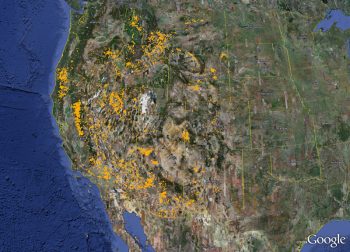
Every list of gold locations names the same famous rivers. To see where prospectors are actually putting down stakes, we counted active placer claims in BLM’s records for the 12 western states our maps cover. A placer claim covers loose minerals in sand and gravel, the kind of gold a panner goes after, but the records don’t say which mineral a claim is for, so not every placer claim is a gold claim.
| State | Active placer claims | Busiest placer counties | Claims staked in 2025, still active |
|---|---|---|---|
| Nevada | 20,166 | Nye, Esmeralda, Clark | 23,333 |
| Utah | 13,361 | Grand, San Juan, Juab | 6,028 |
| California | 10,477 | San Bernardino, Sierra, Siskiyou | 4,153 |
| Arizona | 6,582 | Yavapai, Mohave, La Paz | 5,633 |
| Wyoming | 6,555 | Big Horn, Natrona, Washakie | 3,241 |
| Oregon | 3,615 | Baker, Malheur, Josephine | 1,737 |
| Idaho | 2,911 | Boise, Idaho, Owyhee | 3,405 |
| Montana | 2,779 | Carter, Phillips, Valley | 1,546 |
| Colorado | 2,179 | Eagle, Gunnison, Park | 1,184 |
| New Mexico | 983 | Hidalgo, Grant, Sierra | 1,846 |
| South Dakota | 629 | Custer, Pennington, Butte | 96 |
| Washington | 339 | Kittitas, Chelan, Snohomish | 172 |
Source: Gold Maps Online analysis of BLM mining claim records, October 2026. Active placer claims are the counts on our October 2026 maps. Busiest counties and 2025 claims are from BLM records as of October 25, 2026. “Staked in 2025, still active” counts claims of every type and undercounts the year, because some 2025 claims have already been dropped. Alaska isn’t included in these counts.
A few things stand out:
- The old gold districts are still busy. Yavapai County in Arizona has 2,318 active placer claims, the most of any county in the state. Sierra County in California’s gold country has 716, Baker County in Oregon (home of Sumpter) has 743, and Boise County in Idaho (the Boise Basin) has 664.
- Not every placer claim is for gold. In Nevada, companies stake lithium brine with placer claims too, according to a lithium presentation from the Nevada Division of State Lands. Montana’s busiest placer counties (Carter, Phillips and Valley) sit on the eastern plains, far from the gold districts in the western mountains. A pile of placer claims tells you people want the ground, not that it holds gold.
- People are still staking. More than 52,000 mining claims staked in 2025 across these 12 states were still active in October 2026. In BLM’s history file (as of March 2025), about 67,000 to 70,000 new claims were staked in each year from 2021 to 2023, the busiest years since 2007.
For a panner, the lesson is to use these numbers both ways: a busy gold county shows where the gold is, and it also tells you to check the claim map before you dig.
Free public places to pan for gold
If you’d rather start somewhere you know is open, a few public areas are set aside for recreational panning:
- Marshall Gold Discovery State Historic Park, California. The site where the California gold rush began offers $12 panning lessons, and you can pan with hands and pans only on the east side of the river across the Mount Murphy Bridge.
- Cache Creek, Colorado. This BLM area near Granite is open to recreational gold panning and sluicing. Call BLM’s Royal Gorge Field Office at (719) 269-8500 for current rules.
- Libby Creek Gold Panning Area, Montana. In the Kootenai National Forest south of Libby. Picks, shovels, buckets and pans are welcome, but motorized equipment, sluices and rockers aren’t.
Most BLM and Forest Service land is open too, as long as it hasn’t been withdrawn and isn’t under an active claim. Each of our state pages has a section on where to pan in that state.
At the end of the day, there are thousands of placer gold prospecting locations on public land across the West. A good gold claim map, a shovel, a gold pan and a smart plan are all you need to get started. Our maps show October 2026 claim data in five layers (active lode, active placer, abandoned lode, abandoned placer, and old mines and prospects), and they work in Google Earth and in Organic Maps, which runs offline. Once you’re finding gold with a pan, many prospectors move up to a sluice box, and later to a high-banker, as their skills and their finds grow.