Gold maps that show where gold is being found
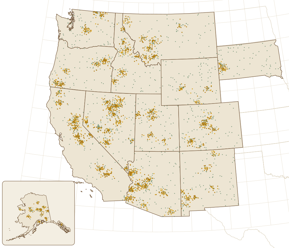
Gold claim maps for Google Earth, 12 western states and Alaska.
Active and abandoned gold claims across the western half of America, shown as a gold map in Google Earth. See where the active claims are, then explore the surrounding areas for promising spots nobody has claimed.

18,900+ prospectors have bought maps since 2010
- Opens in Google Earth
- Works offline
- Instant download
- 10-day guarantee
- Secure checkout, card or PayPal
What’s in every gold claim map
Turn each layer on and off in Google Earth. Claim holders pay a fee every year to keep their claims, and they wouldn’t do that if they weren’t finding gold.
553,823
active gold claims
3,644,794
abandoned gold claims
Active lode
Claims on gold in solid rock, the hard-rock mines and veins.
Active placer
Claims on loose gold in sand and gravel, the kind you pan, sluice or detect.
Abandoned lode
Old hard-rock claims nobody pays for anymore, going back to 1976.
Abandoned placer
Old creek and gravel claims. A record of where people found gold before you.
Old mines and prospects
Tunnels, shafts, pits and dumps marked on old USGS topo maps.
Gold claim maps by state: prices
How it works: download, open, scout
1. Download
Your links show up right after checkout and in your email. Each state is one zip file.
2. Open in Google Earth
Double-click the files and they open as layers on top of the satellite view, with roads, creeks and terrain.
3. Scout open ground
Explore the areas around active claims for promising spots nobody has claimed. Always stay away from claimed property.
What prospectors say
“I used the information I bought off of your site to find and post several claims in Idaho and Oregon.”
Ken Bunkley, president of Alaskan Prospectors
“Gold Maps Online is by far the best time saving, gold prospecting tool we’ve ever had the pleasure of finding. Easy and fun to use, even for a PC challenged prospector like me.”
Johnny Walker, Rocky Mountain Tourism
“As a prospector, I must admit that it has already pointed the way to some areas that I intend to prospect. … The best part is that all of this information is draped over a clear, easy to see, easy to navigate aerial photo of the land.”
Alan Chenworth, author of A Guide to Gold Panning in Utah
Gold prospecting guides
New to prospecting? Start with where to find gold, state by state, and the gold rushes of the American West.
-
How to Check a Mining Claim in BLM’s MLRS, Step by Step
How to look up a mining claim in BLM’s records: whether it’s still active and who holds it.
-
Abandoned Gold Claims Explained: Can You Pan or Stake Them?
What a closed claim is, whether you can pan there, and how to spot them on the map.
-
How to Pan for Gold: A Step-by-Step Guide for Beginners
Step by step, from filling the pan to picking out the flakes, plus how to tell gold from fool’s gold.
Questions before you buy
Something else on your mind? Send us a note and we’ll get back to you.
What do I get when I buy a state?
One zip file per state with five layers: active lode, active placer, abandoned lode and abandoned placer claims, plus old mines and prospects. Double-click it and it opens in Google Earth on top of the satellite view.
Do the maps work offline?
Yes, with the right app. For places with no cell signal, use Organic Maps, a free app for iPhone and Android that works fully offline. Download the map for your area in the app before you leave. The Google Earth app needs a signal to load its satellite pictures.
How current is the claim data?
Each map is built from the latest government claim records, so you get current data on the day you buy. It’s a one-time download: the map is yours to keep, and it doesn’t update later.
Do I need to buy Google Earth?
No. Google Earth is free on Windows, Mac, iPhone and Android.
Can I prospect on an abandoned claim?
Often, yes, but check the land status before you dig. Stay off active claims and private land, since active claims belong to the people who pay for them.
What if the map isn’t right for me?
Every order has a 10-day guarantee. If you’re not happy with your map, ask for a refund within 10 days and we’ll refund your purchase, minus $7 for the download and processing costs we’ve already paid.
Try a free gold map first
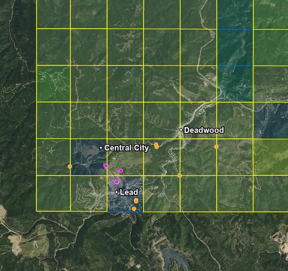
A free map of the Lead–Deadwood gold district from our 2026 South Dakota data. Open it in Google Earth and try the layers before you buy a state.
- All five layers, the same as the maps you buy
- Opens in Google Earth on your computer
- The Lead–Deadwood area only; the full South Dakota map covers the whole state
The download starts right away, and we email you the link too.