Seward Gold Maps
Updated November 2026
Our Seward Meridian gold map shows there are currently 3,864 active gold mining claims, and 2,240 closed claims, all federal claims on file with the BLM. Much of this southwest quadrant of Alaska has heavy concentrations of gold and other minerals but is often only assessable by airplane. There are, however, some highways that will get you to the gold as well.
3,864
active gold claims
2,240
abandoned claims
533
old mines and prospects NEW
State-land claims aren’t on these maps. Many Alaska mining claims are on state land, and those are kept by the State of Alaska’s Department of Natural Resources (DNR), not the BLM. Before you prospect, check the spot with Alaska DNR as well as the BLM.
What you’ll see in the Seward gold map
Start with the whole region
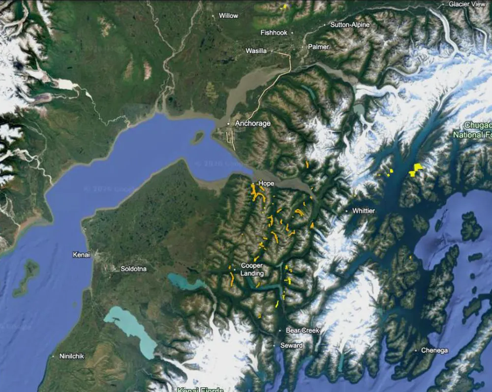
When you first open our Seward gold map you notice claims in the mountains all across the region. This view shows the active claims on the Kenai Peninsula, south of Anchorage. There is a lot of gold here for those willing to live in the wilderness for several months each year, and there are also pockets of gold reachable by car, truck or RV. Be sure to take everything you need because once you are onsite there is little opportunity to drive to a local store for supplies.
Zoom in to the claim lines near Hope
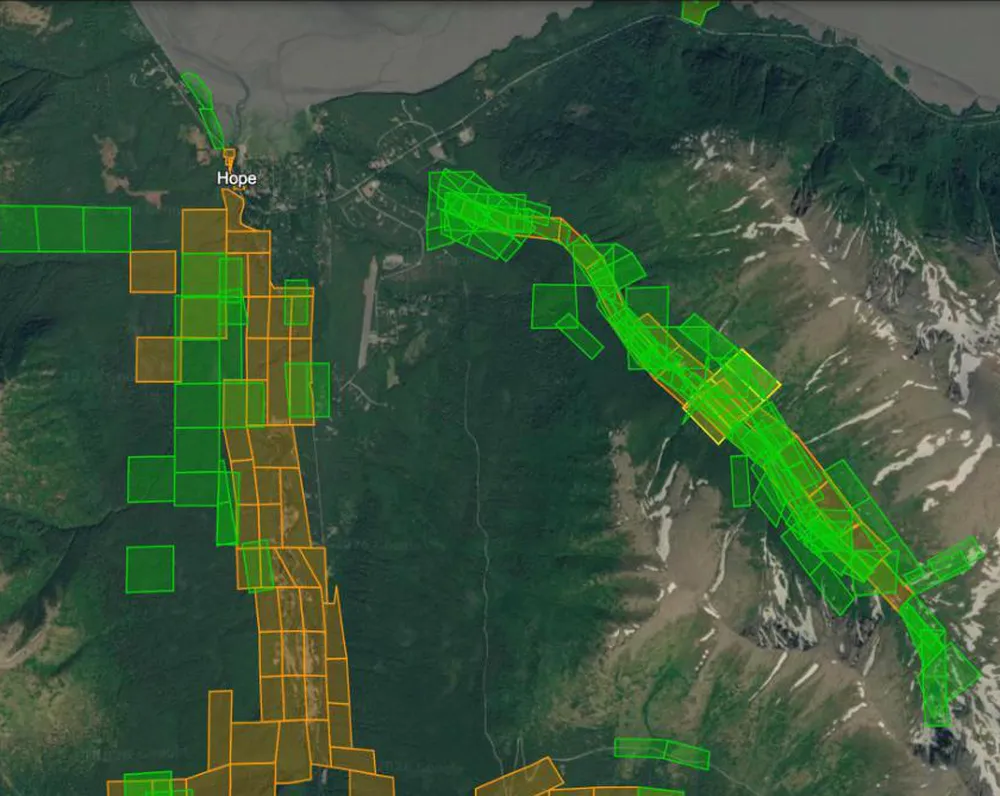
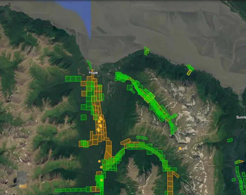
Now zoom in south of Anchorage to a small historic mining town called Hope. Hope is on the northeast shore of the Kenai Peninsula, and you can drive there from Anchorage on the Seward Highway. Orange claims are active placer and green claims are closed placer, and you can see how they follow the creeks south of town.
Click a claim to learn more
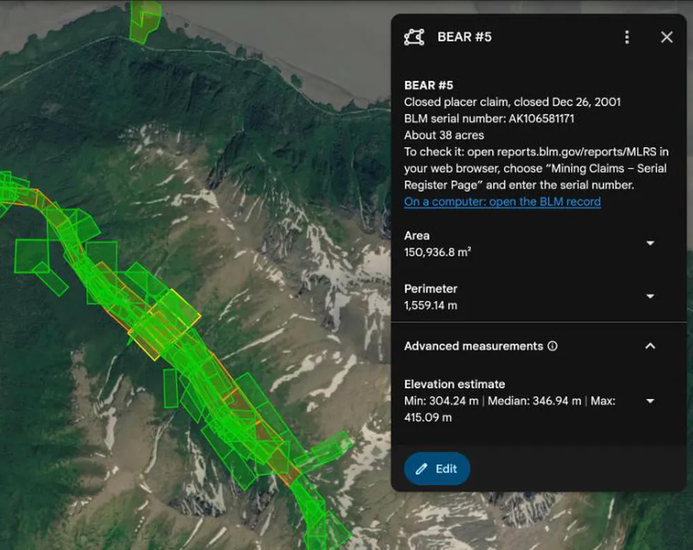
The Alaska maps draw each claim’s own outline. Click any claim and a pop-up shows its name, what kind of claim it is, its BLM serial number and about how many acres it covers. Use the serial number to check it on BLM’s MLRS site before you go. Recreational gold panners should not try to contact claim holders and should always stay away from claimed property.
Find a base near Hope
Zoom out a little and you can see more claims and round pins for old mines south of Hope and toward Sunrise. There are several campgrounds and parks you can use as your base in this area, or you can get off the beaten path and set up camp in wilder country. Bring your guns though, because you are in grizzly bear, wolf and moose country.
Five layers for Seward
One 0.7 MB download. Turn each layer on and off in Google Earth, which is free on your computer. How to open your map
Active lode claims
Gold in solid rock, the hard-rock veins
3,252
Active placer claims
Loose gold in sand and gravel
612
Abandoned lode claims
Old hard-rock claims nobody pays for anymore
535
Abandoned placer claims
Old creek and gravel claims
1,705
Old mines and prospects NEW
Tunnels, shafts, pits, dumps and tailings from USGS topo maps
533
Seward Gold Mining Notes
None of the images above show just how close you can zoom in and see potential prospecting sites. You’ll be amazed at how crisp the satellite imagery is and how much exploring and planning you can do from the comfort of your home.
“As a prospector, I must admit that it has already pointed the way to some areas that I intend to prospect.”
Alan Chenworth, author of A Guide to Gold Panning in Utah
Alaska gold mine and history guides
- The Alaska Gold Rush: Juneau, the Klondike, Nome and Fairbanks Gold rush history
- Alaska Gold Mines Yesterday and Today Old mines
Prices: save when you add more maps
Add more states at checkout. 2 to 4 maps save 25%, 5 to 10 save 35%, and 11 or more save 50%.