
New Mexico Gold Maps
Updated November 2026
Is there gold in New Mexico? Yes. Our New Mexico Gold Maps shows there are currently 14,431 active gold claims and 194,930 abandoned gold claims located throughout the state. Of those active claims, 13,448 are lode claims and 983 are placer. Of those abandoned claims, 176,270 are lode and 18,660 are placer. New Mexico’s roughly 14,431 active gold claims represent about 2.7% of all active gold claims in the lower 48 states.
14,431
active gold claims
194,930
abandoned claims
14,693
old mines and prospects NEW
What you’ll see in the New Mexico gold map
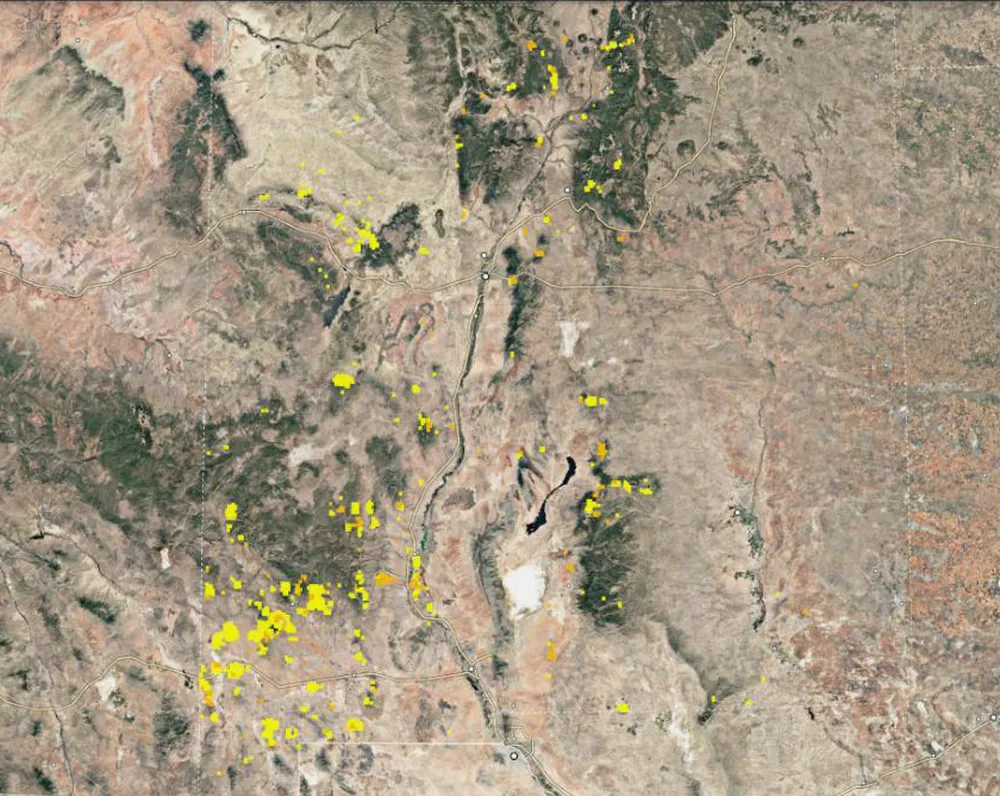
Start with the whole state
When you first open the New Mexico gold map you see the whole state with yellow and orange clusters. Yellow boxes are active lode claims and orange boxes are active placer claims. The clusters show where people hold gold claims today, so you can see where prospectors are working. We rebuild the maps every month from BLM records, which a fold-out paper map can’t do.
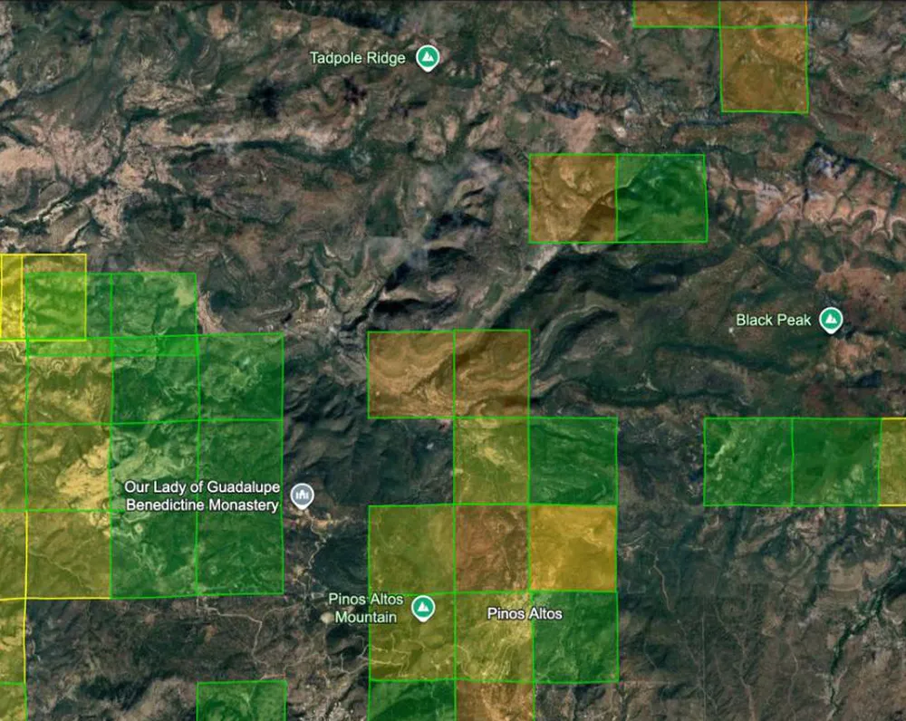
Zoom in to claim boxes near Silver City
Now zoom in about 50 miles northwest of Deming to Silver City, then just north of town to Pinos Altos, and turn on the closed placer layer. Green boxes are placer claims that were staked and later dropped. A filled green box has no active claims in that section today, so it’s a good place to start looking. A green outline still has active claims in it. The Gila National Forest is right there too, so there’s plenty of ground to look over.
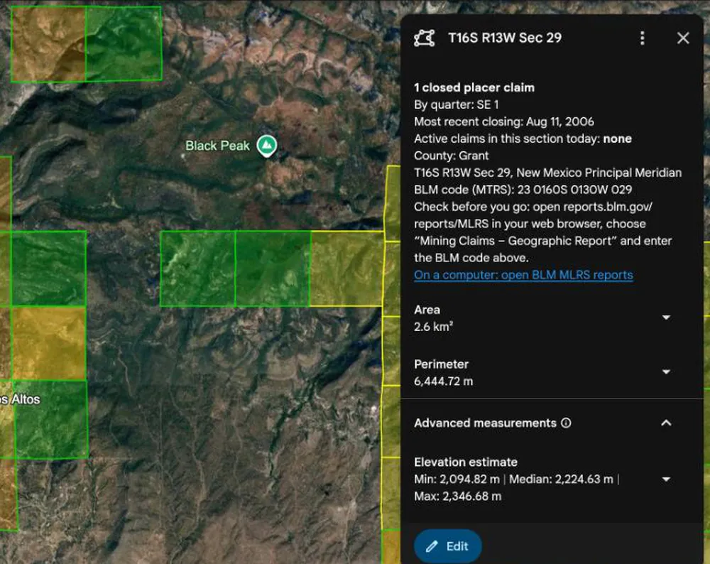
Click a box to learn more
Click any box and a pop-up shows how many claims are in that section, which quarters they’re in, the most recent closing date, how many claims are active there today, and the BLM code (MTRS). Use that code to check the section on BLM’s MLRS site before you go. If the ground looks open and you want to stake it, our guide covers how to stake and file a mining claim in New Mexico. Recreational gold panners should not try to contact claim holders and should always stay away from claimed property.
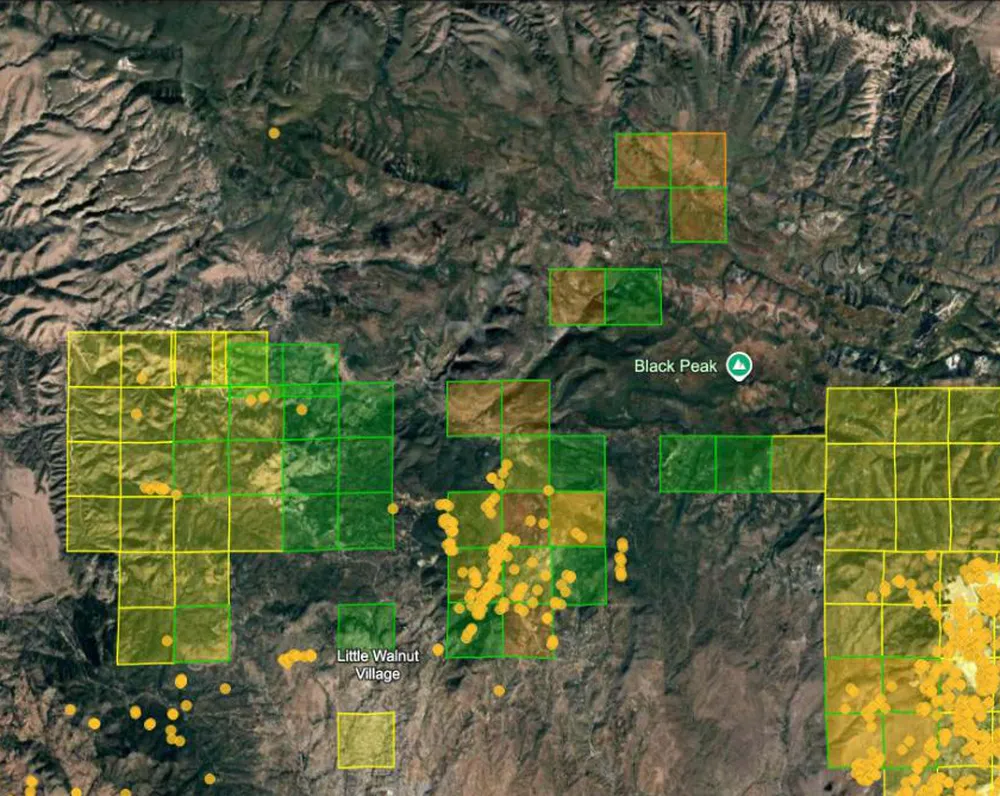
Find old mines near Silver City
Turn on the Old Mines and Prospects layer and round pins mark old shafts, tunnels, prospect pits and other sites from USGS topo maps. They’re a good way to see where people worked this ground long ago. Zoom in further to see roads, creeks and the lay of the land before you drive out. Old mine sites can be dangerous, so never go into a shaft or tunnel.
What’s in the New Mexico mining claims map: five layers
One 2.1 MB download. Turn each layer on and off in Google Earth, which is free on your computer. How to open your map
Active lode claims
Gold in solid rock, the hard-rock veins
13,448
Active placer claims
Loose gold in sand and gravel
983
Abandoned lode claims
Old hard-rock claims nobody pays for anymore
176,270
Abandoned placer claims
Old creek and gravel claims
18,660
Old mines and prospects NEW
Tunnels, shafts, pits, dumps and tailings from USGS topo maps
14,693
Where to pan for gold in New Mexico
Turn on the closed placer claims layer. Those boxes mark creeks and gravel where people once staked claims for loose gold. Pick a spot on public land that isn’t inside an active claim, and pan there. New to it? Read how to pan for gold, what abandoned gold claims mean for you, and our state-by-state guide to where to find gold. Not sure what to bring? See our gold prospecting equipment guide.
Looking at gold claims for sale in New Mexico?
Find the claim on the map before you buy. Click its section to see how many active claims are there, when the newest one was staked, and how many have closed. The popup also gives the BLM code (MTRS) and a link to BLM’s claim records, so you can check that the claim is still active and who holds it. Our guide to checking a mining claim in BLM’s MLRS shows how.
How New Mexico’s mining claims have changed
New Mexico had 10,489 active mining claims at the start of 2015. Today it has 14,431, 38% more. Compare all 12 western states, year by year, on the mining claims by state page.
How close you can zoom in
None of the New Mexico images above show just how close you can zoom in to see gold prospecting sites. You’ll be amazed at how crisp the satellite imagery is and how much exploring and planning you can do from the comfort of your home. Google Earth™ is free to use in your web browser.
“As a prospector, I must admit that it has already pointed the way to some areas that I intend to prospect.”
Alan Chenworth, author of A Guide to Gold Panning in Utah
New Mexico guides
- How to Stake and File a Mining Claim in New Mexico
- Historic New Mexico Gold Mines Old mines
- The Lackluster New Mexico Gold Rush Gold rush history
- How to Stake and File a Mining Claim All 13 states
Prices: save when you add more states
Add more states at checkout. 2 to 4 maps save 25%, 5 to 10 save 35%, and 11 or more save 50%.